Our dedicated team of geomatics professionals uses industry leading methods to capture, manage, analyze and interpret data for a diverse range of projects. We leverage dynamic survey techniques, 3D scanning and modeling, interactive mapping and many other tools and techniques to help our clients and project teams see more clearly, visualize more accurately and comprehend more fully.
Geophysical Investigations
Geophysical investigations are conducted to obtain critical project information and data in a non-intrusive manner, often identifying potential hazards or issues that can not been seen on the surface. We use a variety of geophysical methods to find and understand archaeological sites without disturbing them, assess contaminated sites, locate groundwater and landfill leachate. Our team uses the following geophysical methods:
- EM31-MK2
- EM34
- EM38-Mk2
- ground penetrating radar (GPR)
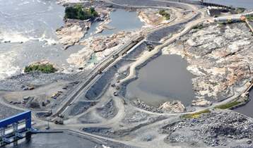
Pointe du Bois Spillway Replacement
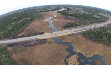
PR 304 to Berens River All Season Road