Our dedicated team of geomatics professionals uses industry leading methods to capture, manage, analyze and interpret data for a diverse range of projects. We leverage dynamic survey techniques, 3D scanning and modeling, interactive mapping and many other tools and techniques to help our clients and project teams see more clearly, visualize more accurately and comprehend more fully.
High Density Acquisition
Here at KGS Group, we’ve found projects often benefit from high density surveying (HDS). This type of surveying allows field crews to capture a vast amount of data cost-effectively, in minimal time, in busy or very large areas. Some of the projects we’ve used HDS surveys for include industrial plants, mines, heritage buildings, power plants, high traffic streets, landfills and numerous others. Our team is adept at providing the following, and many more, HDS services:
- terrestrial scans (3D scanning)
- LIDAR surveys
- RPAS – remotely piloted aircraft system
- mobile mapping surveying
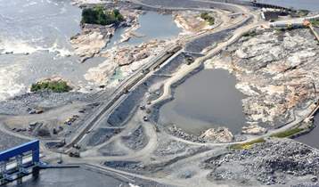
Pointe du Bois Spillway Replacement
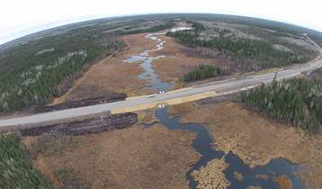
PR 304 to Berens River All Season Road