Our dedicated team of geomatics professionals uses industry leading methods to capture, manage, analyze and interpret data for a diverse range of projects. We leverage dynamic survey techniques, 3D scanning and modeling, interactive mapping and many other tools and techniques to help our clients and project teams see more clearly, visualize more accurately and comprehend more fully.
expertise:
Remote Sensing
By land, sea and air, we use remote sensing to collect vital project information in inaccessible or challenging environments.
Remote sensing tools and techniques at our disposal include:
- orthophoto – aerial or satellite imagery
- image analysis and processing
- RPAS - remotely piloted aircraft system
- thermal infrared
- land cover and land use
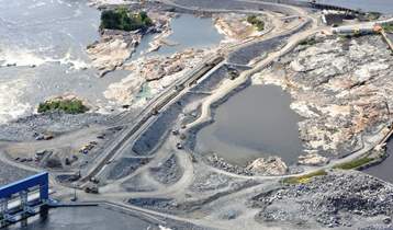
Pointe du Bois Spillway Replacement
Client: Manitoba Hydro
Location: Pointe du Bois, Manitoba
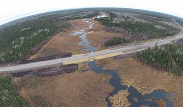
PR 304 to Berens River All Season Road
Client: Manitoba Infrastructure
Location: East Side Roadway, Manitoba
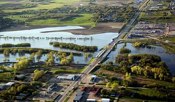
Assiniboine River and Lake Manitoba Basins Flood Mitigation Study
Client: Manitoba Infrastructure
Location: Assiniboine River and Lake Manitoba Basins, Manitoba